04 Mar 2025
Gadi’s Advanced Simulations Help Unravel Ocean Mixing Dynamics During Tropical Cyclones
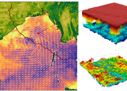
Tropical cyclones (TCs) are among nature's most powerful and destructive forces, threatening lives and properties on both sea and land. Understanding how they interact with the ocean is crucial for