Virtual Research Environments bring together a community of researchers across multiple organisations to enhance collaboration on national and international science priorities.
Virtual research environments (VREs) are developed through coordinated engagement with research communities to maximise the use of NCI’s compute and data infrastructure. NCI’s national leadership in computational workflows on HPC systems and high-performance petascale reference data provides the only research platform in Australia capable of supporting intensive data analysis and simulation.
While this is a collaborative effort with specific community organisations, one particular focus for our work is to integrate the community workflows and tools with our peak computing capabilities, as well as to interoperate with other communities at NCI.
Our work currently focuses on climate and weather, geoscience, astronomy and Earth observation. We engage with our research communities as well as international peers to create these environments, including supporting ongoing improvements across the whole research lifecycle, evolution of standards across the different disciplines, training and user support.
If you have a special interest in the Virtual Research Environments at NCI, please contact us.
Climate and Weather
NCI supports the climate and weather research community through a variety of data environments, including the Climate Data-Enhanced Virtual Laboratory, a dedicated portal for accessing the CMIP6 modelling data, the Australian Research Environment and its Specialised Environments, community user support and the ACCESS model control server.
Geoscience Data-Enhanced Virtual Laboratory
The GeoDEVL project is led by AuScope to provide a new class of services for Magnetotelluric (MT), seismic and geochemical samples.
NCI’s role in the project has been to develop processes for the delivery of national MT datasets through NCI data services, and access to analysis via our Australian Research Environment and supercomputer. NCI delivers tuned MT processing and analysis software that uses the high-performance capabilities of NCI to generate datasets in a reproducible form. NCI also develops services for delivering time-series MT data for the community.
Visit Auscope Virtual Research Environments to find out more.

Digital Earth Australia
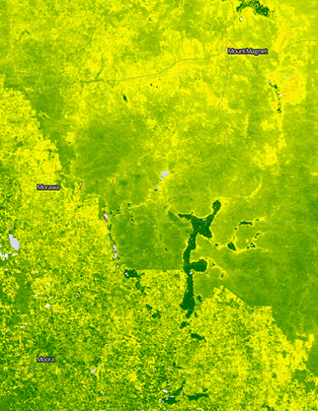
The DEA project is led by GeoScience Australia under a federal government funding initiative. The project prepares vast volumes of Earth observation data of the continent and makes it available to governments and industry for easy use.
NCI provides the high-performance platform for processing the raw data to create analysis-ready datasets, and provides a reference installation of open data cube within our supercomputer and VDI service for analysis. NCI publishes the data via our services, such as the GSKY data service, so that it can be used through Open Geospatial Consortium (OGC) compliant tools and portals. One such portal is the National Map service developed by Data61.
Relevant links:
Australasian Copernicus Data Hub
NCI is the regional repository for the southeast Asian set of the European Commission’s Copernicus Earth observation data, collected by the European Space Agency (ESA) and the European Organisation for the Exploitation of Meteorological Satellites' (EUMETSAT) Sentinel satellites. The regional Copernicus data hub, managed by Geoscience Australia for the Australian Government, includes data covering sea temperature, atmospheric composition, vegetation health and many other environmental variables.
More information about the Copernicus Regional Data Hub can be found at its home page. Access to the data is through NCI’s THREDDS server.
Australian All-Sky Virtual Observatory (ASVO)
NCI has a long term involvement in the Australian All-Sky Virtual Observatory project led by Astronomy Australia. NCI has been involved in the establishment and operations of ASVO from the start. NCI’s major role is in collaboration with the SkyMapper instrument and its data releases SkyMapper DR1 (June 2017) and SkyMapper DR2 (January 2019).
NCI also serves datasets from the MACHO and WiggleZ data surveys.
Relevant links: