For the second year in a row, NCI’s supercomputing and big data infrastructure plays a central role in the winning entry of the prestigious Waterhouse Natural Science Art Prize. The winning artwork for 2020, Open Air, is a video project operatically showcasing the beauty and ever-changing nature of the landscapes around us, using satellite images of Australia stored and processed at NCI, and accessed with the help of Geoscience Australia.
Open Air - trailer from Grayson Cooke on Vimeo.
Associate Professor Grayson Cooke, an interdisciplinary scholar and media artist from Southern Cross University, integrated satellite imagery of Earth into a 68-minute timelapse exploration of the forces that shape our land. By combining layered images of stunning Australian coastlines, rivers, deserts, salt lakes and more with close-up aerial videography of a striking set of paintings from painter Emma Walker, Dr Cooke highlights the similarities in the natural world between the smallest and largest scales. The soundtrack, the complete 2013 album Open from Australian avant-garde jazz band The Necks, provides the structure and flow for the completed video.
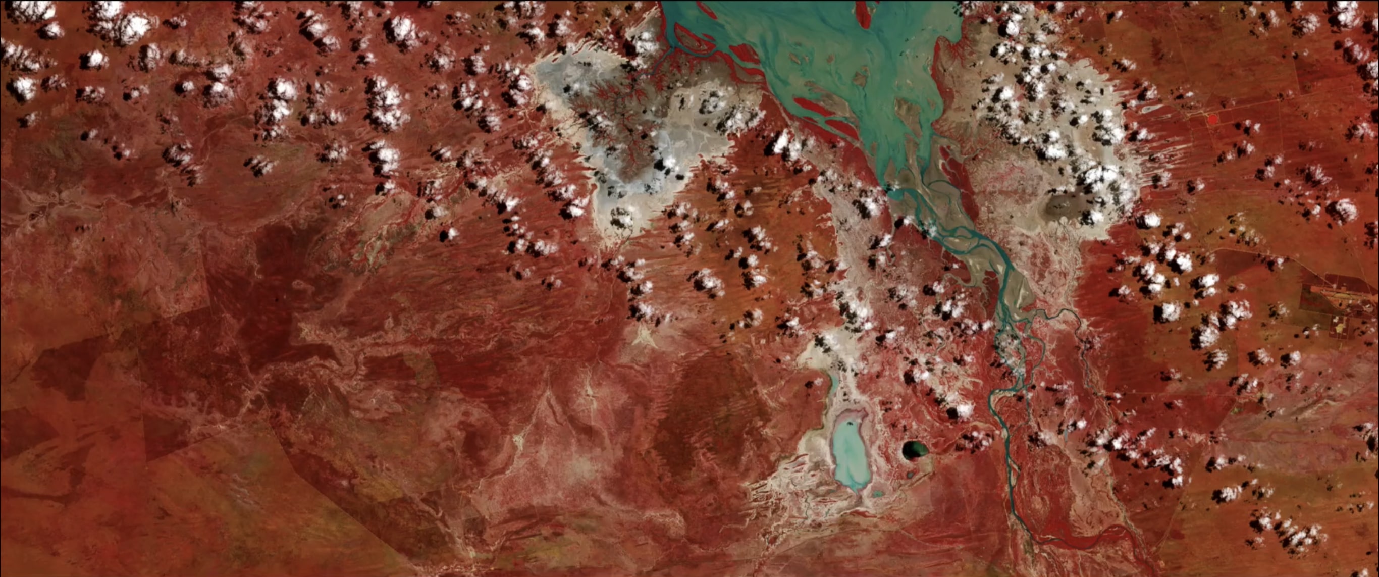
Dr Cooke is enthralled by what can be done with satellite imagery. He says, “You can give people a different perspective on the places and landscape features that they already know. You can render landscapes differently, making them strange or unexpected. Placing the big and small scales of the details from both landscapes and paintings together creates a fantastic effect. There’s a feeling of wonder from seeing the world in this way.”
Researchers can access and analyse satellite imagery stored at NCI through Geoscience Australia’s Digital Earth Australia platform, making use of the data, the associated processing tools and the computational power all available within the NCI suite of services. While most researchers are interested in particular scientific variables available through the images such as soil moisture, presence of water or reflectivity, Dr Cooke applies aesthetic criteria instead. By using infrared images, he puts the water and land in stark contrast, and plays with our expectations of what the landscape normally looks like.
“There is new knowledge to be found,” says Dr Cooke, “when we open up our use of these scientific instruments to more people and more disciplines. Artists are rare among the users of big science infrastructure, but it just makes sense to see what they can learn and find and create with them as well.”
The previous winner, from 2019, was Erica Seccombe for her visualisation of the growth of a fly pupa through X-ray imaging and digital reconstruction methods developed at NCI.