This research highlight was originally published in NCI's 2021-2022 Annual Report.
Scientists are developing increasingly realistic models to better understand what is driving the melting of ice in Antarctica. Using these models, researchers can better predict the Antarctic contribution to global mean sea levels rise under different scenarios, informing global responses to mitigate and adapt to climate change.
One issue ocean modellers face is finding tools that can effectively capture the outputs of complex simulations, as well as communicate insights gained to diverse audiences. To assist with this challenge, a group of scientists have been collaborating with NCI’s Vizlab – an expert team of visualisation programmers – to develop 3-dimensional, dynamic visualisations for their new pan-Antarctic model.
“One of the main benefits of our model is that we are seeking to include the impact of tides across all of Antarctica,” says Mr Ole Richter, PhD candidate at the University of Tasmania’s Institute for Marine and Antarctic Studies (IMAS). “Tides are comparatively very fast processes and as soon as tidal currents are included, a whole new level of complexity and computational intensity arises. A lot of work is needed to maintain numerical stability in the model. However, these tides have important effects, and including these in simulations will enable scientists to better answer questions and open up new areas of enquiry.”
The videos developed with the Vizlab highlight the different processes at play, particularly their varying time scales. “While we can generate lots of plots of simulation data ourselves, these are generally static and 2-dimensional. The videos we made with the Vizlab team show known processes in sharp relief over time, for example the wave-like character of tides circulating Antarctica and the relative speed of tides compared to slower eddies.”
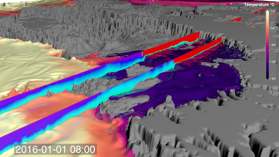
By clearly showing how different processes interact at both local and continental scales, the videos are valuable tools for communicating the complex questions that the model can help answer. “Models are long-term projects, the result of different partnerships and the contributions of many scientists. While we focus on sea level rise, other research groups around the world are already picking up what we have created and using this tool to address specific research questions in fields as diverse as biology, sediment transport and water mass transformation.”
NCI Vizlab collaborations show the innovative way NCI is working with researchers to create products that extend the science discovery process, and help communicate high-impact results more widely.